 Excavating and
 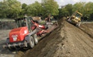 Rough and Fine
 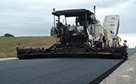 Paving, Milling
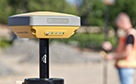 GNSS & Network
 Total Station Solutions
 Mass Data and Volume Collection
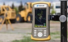 Field Controllers
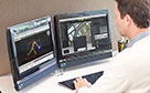 Field and Office Software Solutions
 Laser Solutions
 Levels and Theodolites
 Enterprise Services and Subscriptions
  Support and Warranty
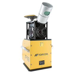
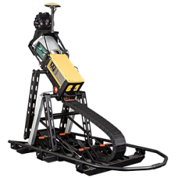
IP-S2 Compact+
Fully integrated
laser scanning and
digital imaging
Transform mapping and asset management data collection tasks by utilising the speed, accuracy and power of the IP-S2 Compact+.

Superpower your GIS Database with geo-referenced point clouds and 3D Images
The IP-S2 Compact+ mobile mapping system overcomes the traditional challenge of mapping linear road or track side features. With a fully integrated approach, it carries this out with a high level of accuracy.
Key Features:
- 3D scanning of road and roadside features
- Delivers high density point clouds and 360° spherical imagery
- High accuracy IMU options without export control
- Simple map, extract, deliver workflow
- Integrated, turnkey solution
Mobile Mapping made easy
Accurate vehicle positions are obtained using three technologies; a dual frequency GNSS receiver establishes a geospatial position, the Inertial Measurement Unit tracks vehicle attitude and external wheel encoders obtain odometry information.
These work together to sustain a highly accurate 3D position for the vehicle even in locations where satellite signals can be blocked by obstructions such as buildings, bridges, or tree lines.
Combined with up to 5 laser scanners oriented to optimise visibility of roadside assets for enhanced scanning details, the standard scanner configuration gives a full 360° vertical field of view.
ADVANCED SUPPORT
Real people + Active community = TotalCare.
You’ll have support wherever you need it — even in the field with your free Topcon TotalCare account. Upgrade your plan to enjoy premium live support and training from industry professionals just like you.
WE'VE GOT YOU COVERED
See it in action
Your local dealer can't wait to show you what we can do for your business.